Following a short respite from severe flooding, the Northeast is predicted to experience more rain and thunderstorms starting Tuesday. A risk of strong to severe storms also looms over the Midwest and Ohio Valley on Monday.
The primary areas expected to be impacted by severe weather on Monday include Iowa, Nebraska, Kentucky, northern Tennessee, southern Illinois, and southern Indiana. By Tuesday, the flash flood threat will shift towards regions near New York's eastern border.
National weather forecast for Monday, July 17. (Fox News)
Canadian wildfire smoke will continue to affect air quality across a wide swathe of the U.S., from the Northern Plains to the East Coast, over the coming days. Air quality alerts are currently in place for numerous states, including Minnesota, Iowa, Illinois, Michigan, Indiana, Kentucky, Tennessee, Ohio, North Carolina, Pennsylvania, New York, and Vermont.
Projected wildfire smoke coverage in the U.S. (Fox News)
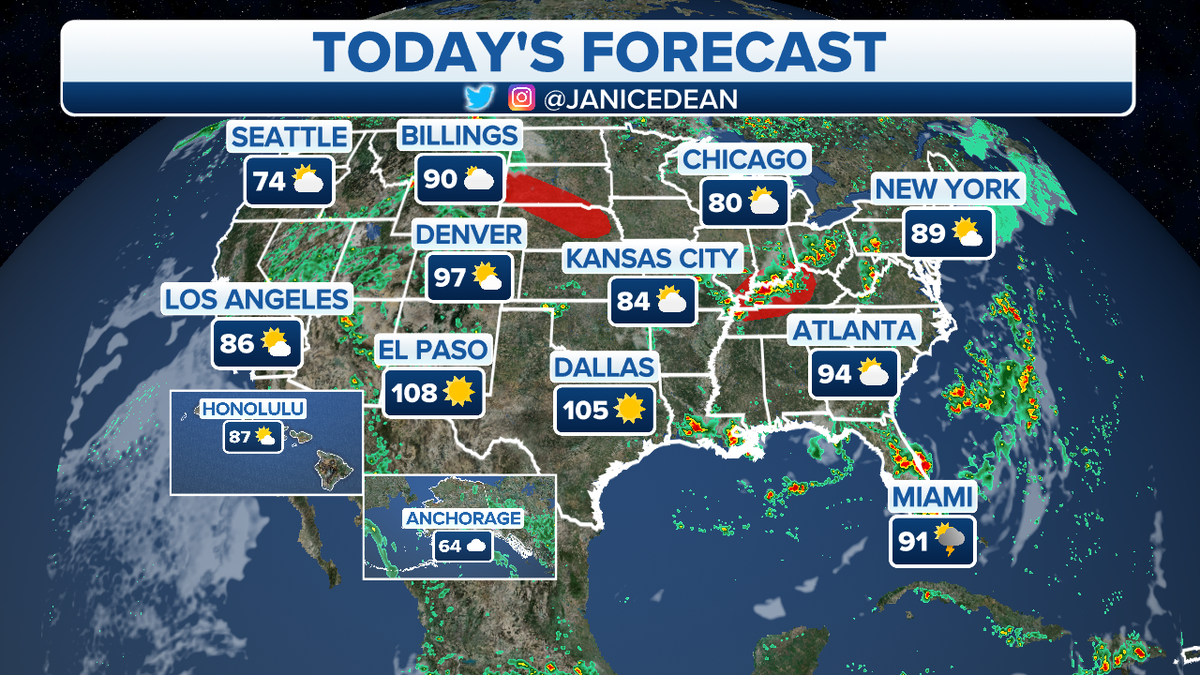
Upstate New York's Adirondacks region is anticipated to experience the most significant smoke impact. Concurrently, extreme heat continues to pose a serious threat across the West Coast, Southern U.S., and Florida. Cities like Phoenix, Las Vegas, Salt Lake City, and Denver are bracing for temperatures exceeding 100 degrees Fahrenheit.
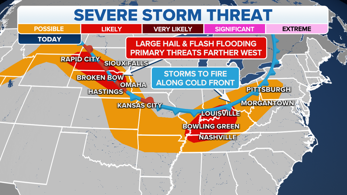
Severe storm threat forecast for Monday, July 17. (Fox News)
Comments(0)
Top Comments